Posts

Showing posts with the label 27

Nasty in the Middle

Image
Cedar heading down one of the many firelanes On the weekends we have been trying to avoid the more crowed parts of the park so it's easier to practice social distancing. Well last weekend it was in the 80s and it didn't matter which end of the park we were in or which gnarly firelane we took, there were people everywhere. But all but 1 person were very nice and tried to maintain as much distance as possible.  Susan and I have been participating in Wyeast Wolfpack's Climb 4 Community , which is a virtual challenge that over the course of 2 weeks you try and run either the distance around or complete the elevation to the top of some of the PWN's most iconic mountains. I've been averaging 50-55 miles each week since Covid-19, so the distance wasn't a challenge as much as the elevation. I decided we should run the NW Nasty, but it's only ~11 miles, so I added ~9-8 miles on either side of it. So now you have Nasty in the Middle. Cedar enjoying a roll in the gras...
All the ups and downs

Image
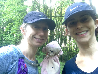
My son loaned me his lovey for our run-- as long as I didn't get him stinky. Thought I'd have a little fun and make us hit lots of the trails between Wildwood and Leif. My first iteration was only 20 miles, and by the time I got that far into route-making I just used the easiest method of adding on. So there's a longer stretch on Wildwood from Nature Trail to Ridge. The multiple, short climbs break things up nicely. Firelane 4 is difficult to run even downhill, so might as well go up it. I knew the hike up Firelane 4 would be overgrown, but I didn't realize there'd be stinging nettles there, too. Now that's incentive to get up a hill quickly! Moss creeping in on Firelane 3. Dogwood to ww (8.47)-- .66 mi ww (8.47) to Alder (ww 9.40)-- .93 mi (1.59 total) Alder (ww 9.40) to Leif (1.49)-- .84 mi (2.43   total) Leif (1.49) to FL 1 (le 3.03)-- 1.54 mi (3.97   total) FL 1 to Nature-- .53 mi (4.5   total) Nature to ww (11.83)-- .65 mi...

NW 53rd Nasty + Saltzman

Image
Susan and I have unofficially started to train for the CCC , the little sister race (101k) of the UTMB . (I only say unofficially, because Susan hasn't completed her registration yet.) The last two weeks we have increased our mileage from 20 miles to 27 for our long runs and we have also tried to add in more elevation gain/loss, which can be a challenge in Forest Park. This time of year most of the trails in the Gorge and around Mt. Hood are covered in snow so there aren't a lot of other options for trail running besides Forest Park, which is means we will be getting creative with trying to increase our elevation gain as we increase our milage. One of 4 trails that touch NW 53rd  This week I decided to focus on all the trails that touch NW 53rd and zig zag up and down them and add a climb all the way up Saltzman. When we started the run my legs were already tired, I ran 50 miles the week before, which is probably 15-20 more miles than I have done in awhile. I mentione...

Eagle Creek - Ruckel Creek loop

Image
Susan and I took a day off of work, just before I headed out of the country again, to run a 27 mile loop in the Columbia Gorge on Eagle Creek to Wahtum Lake and Benson Plateau and down Ruckel Creek. I few years ago we ran a 22 mile  out and back on Eagle Creek and ever since then I have wanted to run the loop. I backpacked the loop years ago and had awful memories descending Ruckel Creek and was hoping running it would make it go by quicker. Ruckel Creek is ~4 miles downhill with a descent of ~4000 feet, but more about that later. William Sullivan's map The weather was forecasted for possible rain in the afternoon, but in the low 60s most of the day. Perfect running weather. I didn't anticipate that I needed a long sleeved shirt until we got to the trailhead and got out of the car. Luckily Susan brought one and arm sleeves, so we were all set and ready to go. One of many waterfalls Ann near the start The Eagle Creek trail is one of my absolute favo...