![](https://blogger.googleusercontent.com/img/b/R29vZ2xl/AVvXsEgezSHCbdTLPAcy0Pz3u77M7UP8UitZMUPJEGbpsCA6DK66ZOJbel_DPjWMzE16CL-L8vhVVD7A52Yu4TL0NRI5tFA0gayGH4cwmYQVJUr9GxgqDLUniO4X3p94idCmtXpMKsz6bbcmwOLf/s320/IMG_7231.jpg) |
Beach along Cavalière Valmer Rd |
After a full week of vacation, I was ready for a run. I usually don't bother to bring running gear with me, but this is also the first two-week vacation I've taken in more than four years. Nowadays that's far too long to do without.
![](https://blogger.googleusercontent.com/img/b/R29vZ2xl/AVvXsEheLB5uQNpRmYR3XdBvxLrGZadMTHQGfUEj5kBDmtX4L-mHM_RPYTqKfcLjlN8dQ6AmGy1Fsbge4UXOPK3gBApRXhB28itzbyYTvlC-L_uonAOs4tYU6sWQcCa0VF72U5ebVN24ejXedefU/s320/IMG_7232.jpg) |
Sidewalk above the beach |
I found a boxed set of walks in Provence, and searched out the one closest to the house where we're staying. Surprisingly, it was right down the road. Even better, there's a surprisingly long network of trails, making for varied options in the coming days.
![](https://blogger.googleusercontent.com/img/b/R29vZ2xl/AVvXsEhj9o5_TnL_e_JItnR36Km_Hu9isO0tGqUyvh0FF4vjFu8hEaEGqAhpjGnx3UQUl06US9ZErD82tZqpl7C4XpwJJpNIlztFooG3G3gozIb_Y6qAel7QvmplFUF-DmXNobxFVbHt2Pm2SJTV/s320/IMG_7233.jpg) |
Map at the trailhead: Vous êtes ici! |
I was nervous about getting lost, since so many little false trails head off the main one, and you can't always tell if you're going out to a viewpoint and dead end, or just a short alternate path that will meet back up with the main trail. Luckily, there are lots of signs with directions and distances to main points of interest.
![](https://blogger.googleusercontent.com/img/b/R29vZ2xl/AVvXsEhVo5N4aURTUe5dhT7__Edo_amhQLfjINte_kmLblCzMK0SEIfjRAbPs5lJYiyByuvDGqRQ2FdqYhBbA3mzKnmh5Wqmocdf2icVJEVoQweQIT4hoExO6SqGPqKmoSGtH7MU2neEXIYBPep9/s320/IMG_7234.jpg) |
Trail climbs up past Gigaro Beach |
Since it was the middle of the afternoon on a Saturday, the narrow coastal trail was pretty crowded. I often got stuck behind a couples walking, deeply engaged in conversation; I'm not sure how to say a polite French version of "on your left."
![](https://blogger.googleusercontent.com/img/b/R29vZ2xl/AVvXsEjL-TcK4OMj3YBhRVNvm0BJa6BtqM50cFKM4rsAz3xsWuP01R6ETcyI02TaRjn9WzrQ6ebNryIy8SLWcfeHx2Nqqw7LUR1VHoFj1cn9KZAKwohY0T9BOM514nRuNR8UdRjDoNLM4K3cRGWM/s320/IMG_7236.jpg) |
L'îlot du Crocodile-- tiny rock island that looks like a half-submerged crocodile |
It was nice to catch my breath and take in the views from time to time, because there were lots of stairs-- climbs up and down, carved into rocks right by the water and big blocks of wood set into steep hillsides.
![](https://blogger.googleusercontent.com/img/b/R29vZ2xl/AVvXsEjkBRWNijNo6vZr_sN8sDwtoWLUxigXrA_JiWtiDTJCx1zwF_eVjhkYUvk-XNQ8jTqGQPSPGYeFO14_QZeepZp7bydhziwmfXf7JKny065guHbMRiOzUYNzr670A8-TNt3xGGQbRDUZplws/s320/IMG_7237.jpg) |
Boats anchored in a quiet inlet |
While the trail along the water is small, twisting and technical, the route I took to return was a wide, dirt and gravel road. It was well-graded and less crowded, but not exactly smooth going-- rutted and overgrown in places, with fewer views but a welcome change nonetheless.
![](https://blogger.googleusercontent.com/img/b/R29vZ2xl/AVvXsEg_gvW7m9ocO93pltlT2vJm_OZWiy5BCm-SMjx1u4qbE0ZGv552qKzZG7_gKVYjdR4g7eWJ0DwNkK1hfboAkqypfIe2bjScDN7vRPiDWd4P0gt_Ygem-dQArI_QFqHJZoYkXB3xaGNop7tf/s320/IMG_7238.jpg) |
Many trails, well signed |
I can't wait to try a few more trails and destinations next time!
![](https://blogger.googleusercontent.com/img/b/R29vZ2xl/AVvXsEiIIz1QkqCNktEabvW3H7j7vnw-SOgJ6wPr0-qAstiYkEisTNwakr7hQoEBSmMouN9X_7G3g2B6Fc299VHIPhHccBTcFY76T0Fzq3ooKR1xVAzWD9xm2Vr4XQb2cHz5Xp70c5OYp-Inq9Nv/s320/IMG_7239.jpg) |
Steep, rooty steps |
![](https://blogger.googleusercontent.com/img/b/R29vZ2xl/AVvXsEgOc6bdWGi0jwuCM93zZ75Uh_BouKS6gjs2ai9GGiv4L5ZyyoE4PyLlO6RBNJcnYtvvTCybC6vCuB5C6mCGq6gOFoZy5JsVNQircXkXPIUmGHJ5qZiBdKdjaF9EWUs6oCyb7Zfy8JVXSqYY/s320/IMG_7240.jpg) |
More steep stairs to climb |
![](https://blogger.googleusercontent.com/img/b/R29vZ2xl/AVvXsEi8xZLIngHvhmmZ_F_WJB7MuEQs8bYPFsuDZ9sU-PnxOIN7p5ubslayqP2Gx8Mu9h-6t_Ux3urYXPRmzo26ZdO4RSyros3RPLvjccYtRWYf7XZut73RKSEkX8XEus0mfaTEOJbsFe9d9atR/s320/IMG_7241.jpg) |
Views of the Mediterranean from up high |
![](https://blogger.googleusercontent.com/img/b/R29vZ2xl/AVvXsEj6HBMVEy0tc-6VHA9WB7CbUS-5GDGjTz2_i5wfH9QFpA9HdY8fbTq17IS_NCxF6YyAWjk4FN6S0L1m9y-YELtYcbN1p9Iq58a3E-bz1nplmSYzLiOAsV1yu_vHQBSU5DwuhJYMTpZLbO9k/s320/IMG_7242.jpg) |
Wide gravel road trail, with tree-covered hills in the distance |
![](https://blogger.googleusercontent.com/img/b/R29vZ2xl/AVvXsEhSNPWAveI0Hajh28n5BGb94N5mxCZbXdgE15ODxdNAEOZbQcjnNpA9aLE9vgqSpeZQZcdQfXoZY9hozrtG56-4FuNL1-pq5nQoHR2AmDZRaA89tvaCbFQF7W0HAki-_vxIqFAoa-WHqC2E/s320/IMG_7243.jpg) |
Views from the road |
![](https://blogger.googleusercontent.com/img/b/R29vZ2xl/AVvXsEg0y_mi11JtEvSrtX3WG6cVSx02umfoYkdwZGnP2Wy1Ps8hmqPaVH-AjyLufituXhGSG4iw2zod92My4oVwGOLVDKQVpLKyyxTIZzzSYv3j-luZzVjYpMW5kT_YUQPkxIzDaZFbjyKCBOWr/s320/IMG_7245.jpg) |
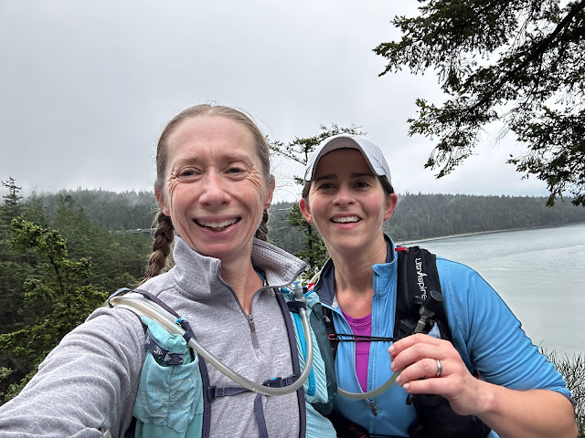
Selfie near the top/ Les Pins Blancs |
![](https://blogger.googleusercontent.com/img/b/R29vZ2xl/AVvXsEhAVheDHq5LPR7zaVdSVw6z5eggR8UoVvR3rdWq1ZJ0En48wJAPtPKPrCmwFhWULpO-2ZhvNcGqEGcguA4NX7QIPoND7sJRh4NNjtOYfitepkS_gwlCO-HDJiqgC3BFKsj4ZDb4CLcsmFOG/s320/IMG_7246.jpg) |
Some good distance options for next time |
![](https://blogger.googleusercontent.com/img/b/R29vZ2xl/AVvXsEiKtDYjTIanUV_XJycNHnsumfIu41D7Hz2KvjZRmULHFPQGGm7Y4XgSaqOWex0qafQHwBYna6li0wjkXpiNnEZIdv8jDri4XNIoO8KPymft0JVMWrAvS0Kl5c_w3YL5ZAZkzy3lEB-MMXwQ/s320/IMG_7235.jpg) |
Sweeping views of rocky bays and inlets |
![](https://blogger.googleusercontent.com/img/b/R29vZ2xl/AVvXsEjmdipAhaRXRbdlMI7wa4mrxMPocv1VrMo2M5ksjk_omrI8z9bGLzevNMgcVTNbcVY3ZDPPXaZyQbUZC_HK9o7V3fW3x8Zi3BKTzGo-xpuuVhVpaTzd_BdEk63E1G39sdJ7X8PpkzNcO4h7/s320/Screen+Shot+2013-09-14+at+10.18.43+PM.png) |
Nike+ map of my route |
En votre gauche
ReplyDelete