Posts

Showing posts from 2017

Grand Canyon R2r2R

Image
Grand Canyon shadow and light Somewhere in the flurry of recent FKTs and friends doing it, the dream of running the Grand Canyon from one rim to the other and back took ahold of me. I wanted to do something that would match the epic natural beauty of the Mt Rainier run we did two years ago, but in a completely different way. The canyon is the opposite of a mountain, and its desert environment is the opposite of the Pacific Northwest’s lush rainforests. I did a little research and was surprised that the distance (43-47 miles, depending on which trails you take at the South Rim) and the elevation gain (an 5740 ft climb up the North Rim and a 4340 ft climb up the South Rim for a total of 10,500 ft) seemed doable. Hell, those are stats we’ve already done: a circumnavigation of Mt Hood on the Timberline Trail gains 10,000 ft in about 42 miles.

Last long run of 2017

Image
When I asked Susan how far she wanted to run this weekend, she said more than 20. Since I really like the number 23, I decided that would be the distance for our last long run of the year. I was going to create a new route, but got lazy and picked a route from our archives. John dropped us off at the top of BPA and we cruised down to Wildwood and took a right and headed towards Springville. We were deep in conversation about the holidays and changes coming in 2018 Susan said, "how far is Springville?". I said it was only 5 miles from BPA. We both looked at our Strava's and we had gone more than 5 miles, but we were sure it was only a little further. When we hit Trillium, we knew for sure we had missed it. We were both a little confused on how we could of missed a large forest road.  Top of BPA We looked at the route and decided we didn't want to back track too much and would just make it up as we went along. Both of our Strava's showed different dis

Annual Birthday Run

Image
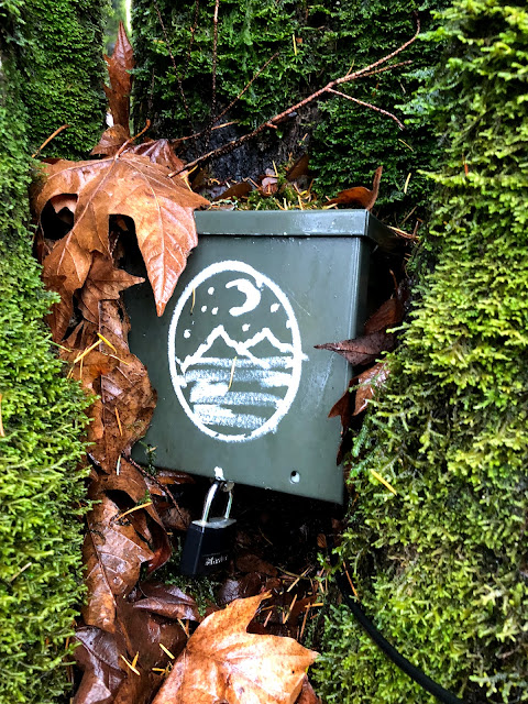
random box in the park Mine and Susan's birthdays fall at the end of November and for the last ~6 years we have run Wildwood end to end to celebrate. We try and alternate which end we start from. This year the weather looked like crap and we decided that we would just run from the end of Wildwood (Newberry) to my house (Birch trailhead) and do the full end to end the  following  weekend.  The Newberry trailhead After about 10 miles / 2 hours of running and no rain, we started to question our decision not to do the full end to end. I told Susan that if the weather was still decent when we got to Birch we should call John and see if we would be willing to pick us up at the zoo and do the full 30 miles on Wildwood. We both thought this was a great idea, we always have our best ideas mid-run. The weather did hold out and John agreed to pick us up. Luckily we both had packed enough food and water that running an extra 7.5 miles was no big deal. I was a little worried

2017 Gift Guide for your favorite trail runner

Image
It seems like all the cool kids are publishing gift guides, so we thought we would post some of our favorite things.  Tribute to the Trails 2018 calendar   Susan has given this calendar to me and David the last few years as a Christmas gift. Not only does it have amazing pictures of races around the PNW, it also supports the Washington Trail Association .  Spot Device I don't currently own a Spot, but I am pretty sure there is one under my Christmas tree. After listening to several podcast with Candice describing how well it works for her 200 mile races for tracking and finding people, I knew I needed to get one, especially after our misadventure at  Siouxon Creek . Black Diamond Carbon Z Poles I love these poles, they are super lightweight, durable and compact. We never go on an adventure run without them, we use them frequently for tricky stream crossings and technical downhill / uphill sections. When they are stowed away I rarely notice they are there.

A Weekend in Stockholm

Image
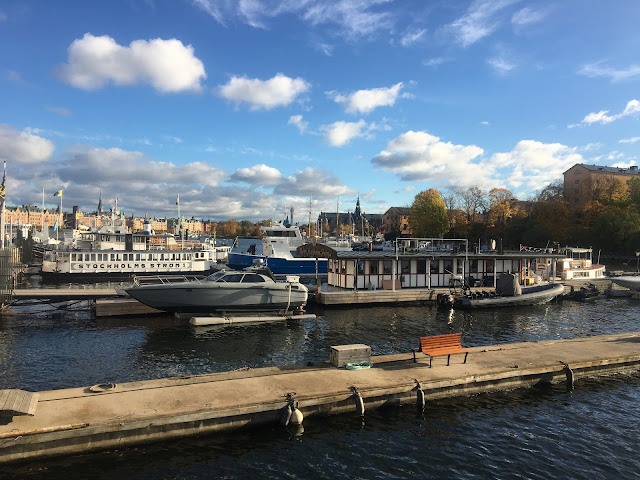
My husband is traveling for the better part of 2 months for work, one of his work trips was to Sweden, I had never been to Sweden and didn't want to go almost 2 months without seeing him, so I asked my boss if I could work remotely from Europe for a ~week. She said yes! We also have a good friend, Karrla, from Portland who is currently living Berlin, who decided she was going to meet us in Stockholm for the weekend.  Since I only had the weekend free in Stockholm, I didn't do a lot of research on what to do, I figured we would look at Trip Advisor and go from there. The NY Times recently published  36 hours in Stockholm , so we decided to loosely base our weekend around that.  View from my hotel room Here is our take on 36+ hours in Stockholm. I arrived Friday around 1pm and was extremely jet lagged, so a lot of Friday was a blur, luckily Karrla was there to drag me around. After a quick shower at the hotel we walked around  Gamla Stan , Stockholm

The perfect 20(ish)

Image
The perfect view Sometimes you have the perfect route, the perfect weather, the perfect view, the perfect running partner, today was one of those days. This was our first 20 mile run since attempting the Grand Canyon R2R2R five weeks ago. It was nice to take it easy for the last few weeks, but with 2017 coming to an end and starting to think about our 2018 race and adventure schedule, I am ready to start increasing our mileage.  Route: 53/Dogwood - Keil - .10 Keil - WW - .17 WW - Pittock - 5.78 Pittock - Apson - 2.58 Aspen - Thurman / Leif trailhead - .75 Leif - Dogwood - .85 Dogwood - WW - .34 WW - Alder - .96 Alder - Leif - .84 Leif - Maple - 2.69 Maple - WW - .82 WW - Keil - 3.55 Keil - car - .27 Total: 19.70

Yellow Jackets, Bears and the route from Salmon River to Timberline Lodge

Image
Susan heading up the PCT to the Timberline lodge A month from our first attempt at running the bucket list run of most MUT runners, the  Grand Canyon R2R2R , we wanted to get in one big run outside of Forest Park to help clam our anxiety, despite having an amazing summer of adventure runs. We decided to take a Friday off of work 2 weeks before running R2R2R to  run around Mt. Hood , which is similar distance and elevation gain as R2R2R2, though very different trails and environment.  A week before our planned circumnavigation of Mt. Hood, we got ~18 inches of snow above 5500 feet on Mt. Hood, which covered a lot of the Timberline trail. So, as with most of our adventure runs this summer I had to come up with a Plan B. Fall! Earlier in the summer when I planned our   Salmon River – Devil’s Lookout – Hunchback Mountain  route, I noticed on the map you could run from Salmon River to the Timberline Lodge. I pulled out the map and calculated the distance and it was